
OUR SERVICES
OUR SERVICES
We provide a wide range of professional surveying services and consultations to meet your needs. We promise to provide every service with integrity, and to your highest level of satisfaction.
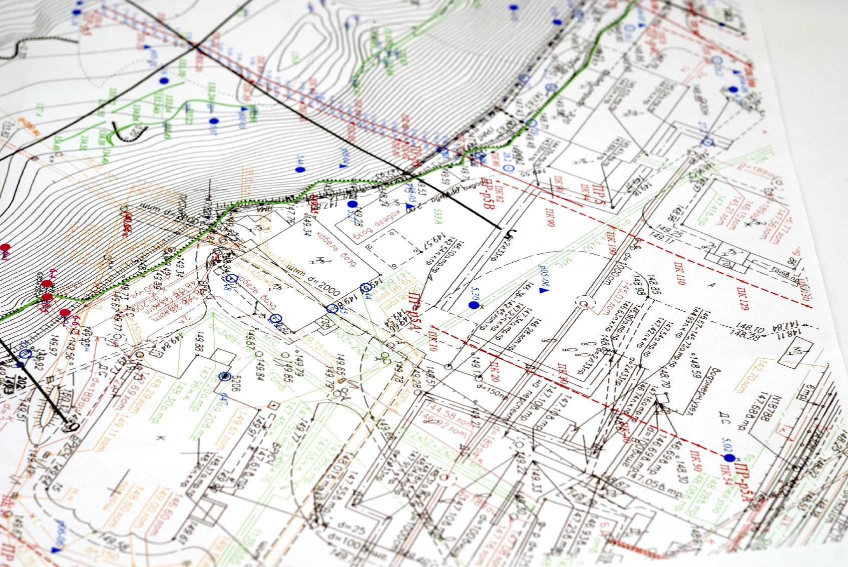
Topographical Surveys
Topographical Surveys
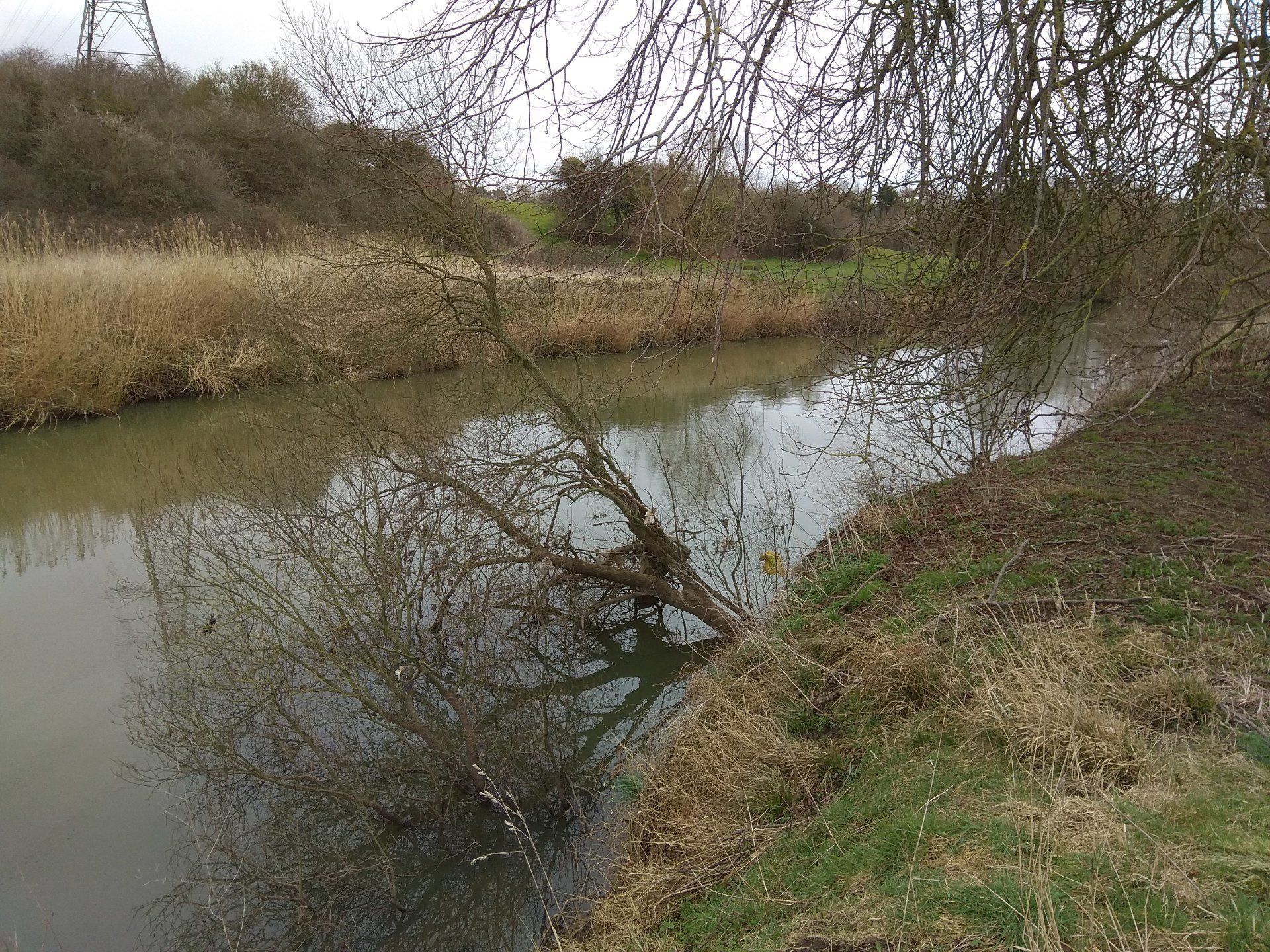
Since the company’s incorporation, Bernard Geomatics Limited has embarked on numerous topographical survey projects throughout the UK and Europe and has successfully maintained full customer satisfaction with zero complaints from individual clients or organisations that it has engaged with. Drawings and plans derived from the topographical surveys are used by a wide range of industry professions ranging from civil engineers, architects, railway and highway designers to geologists and many others.

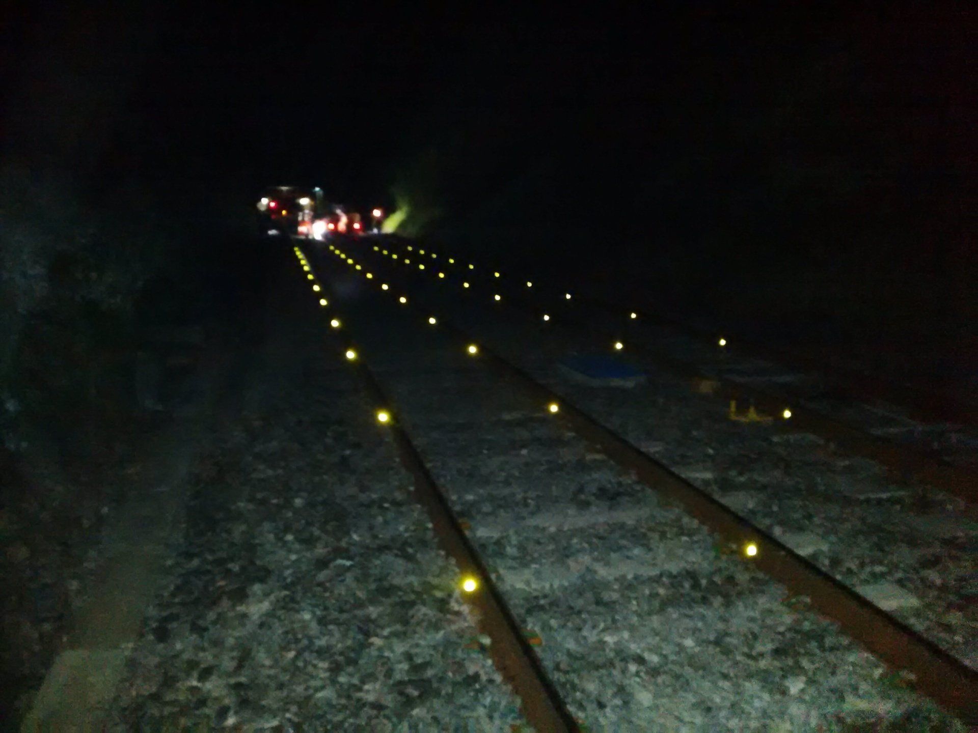
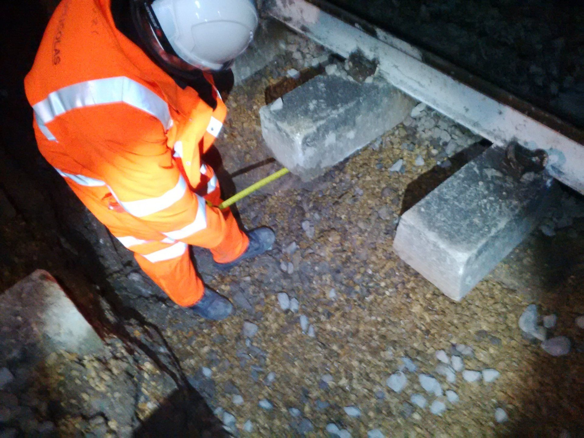
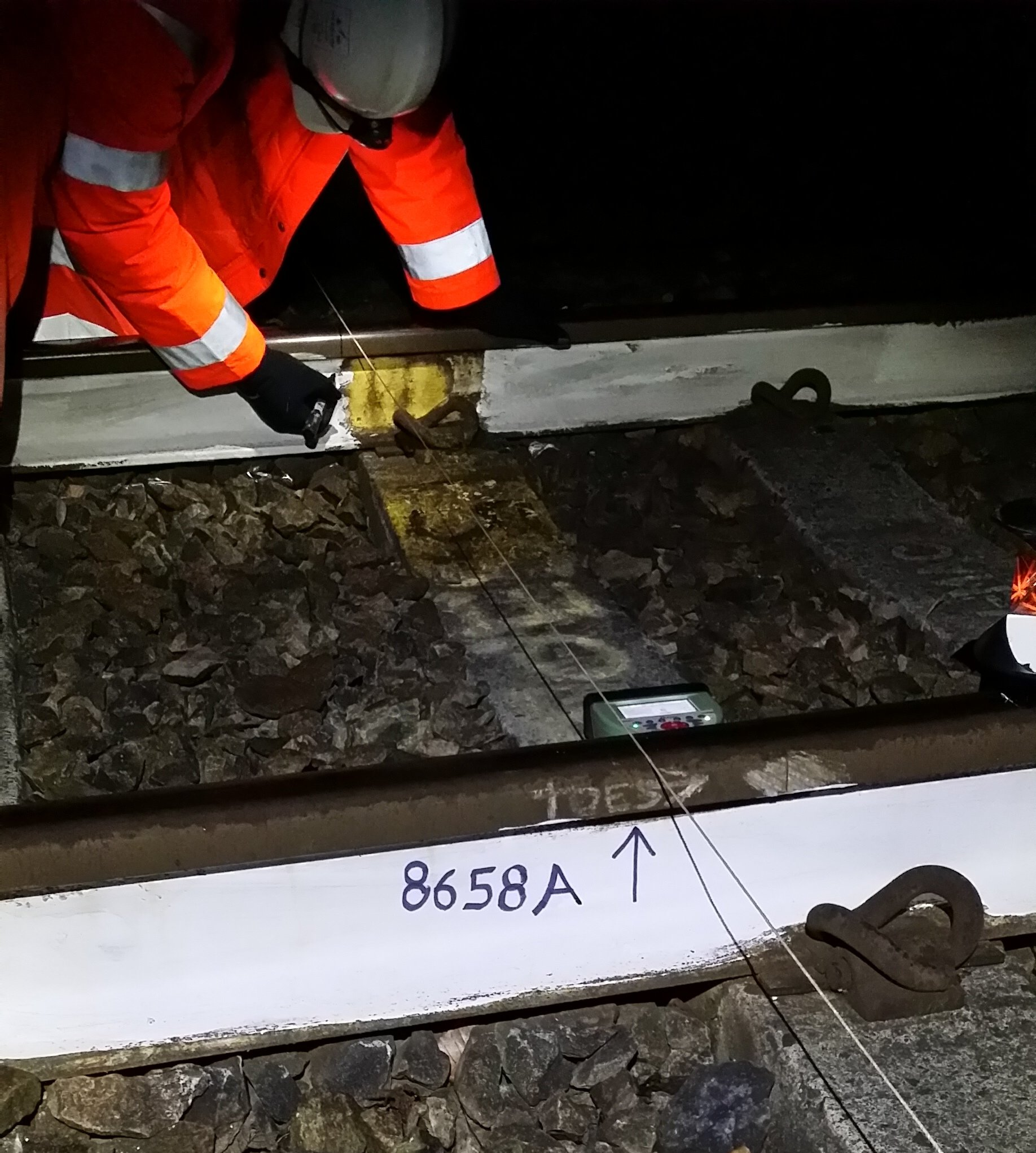
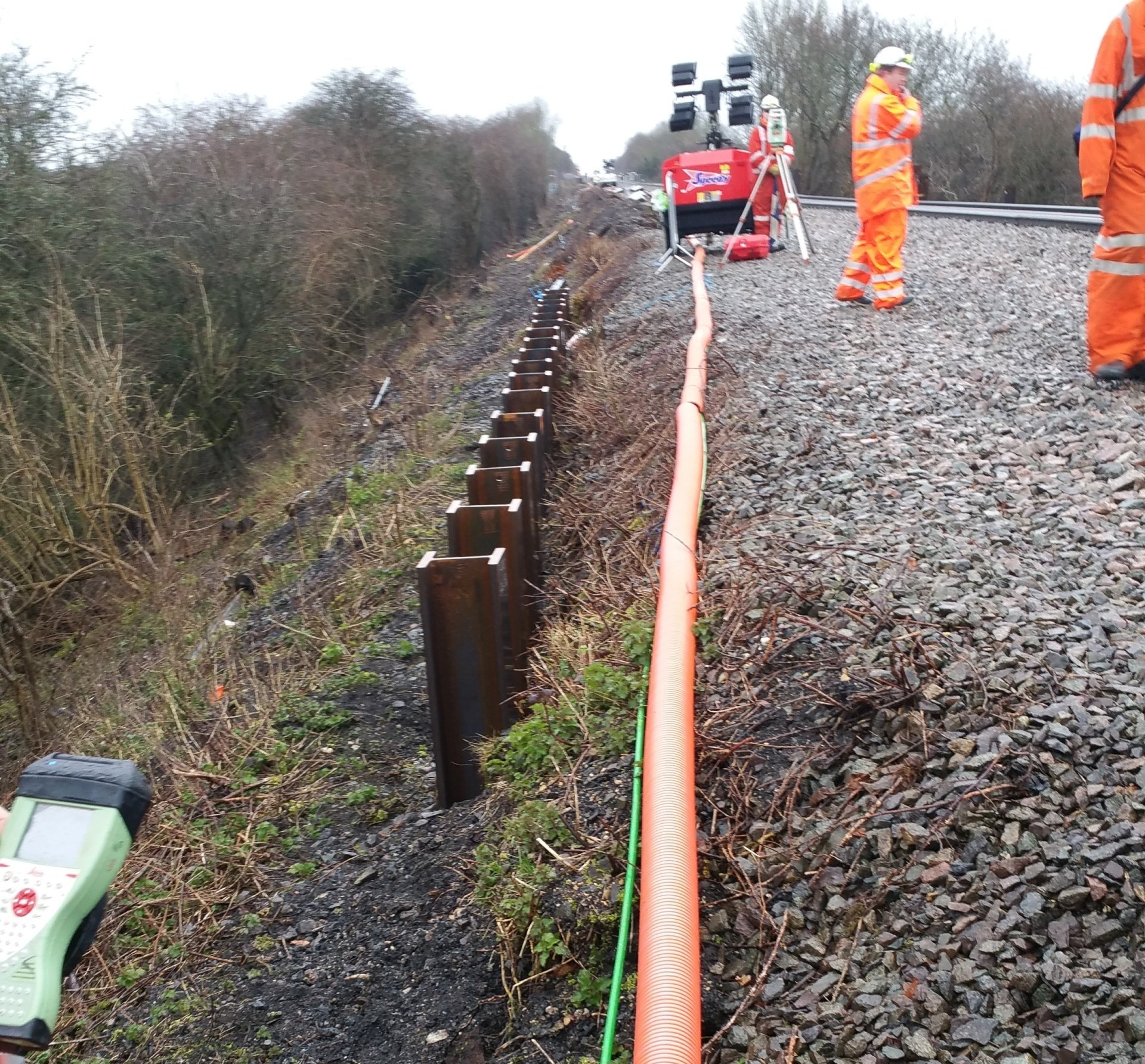
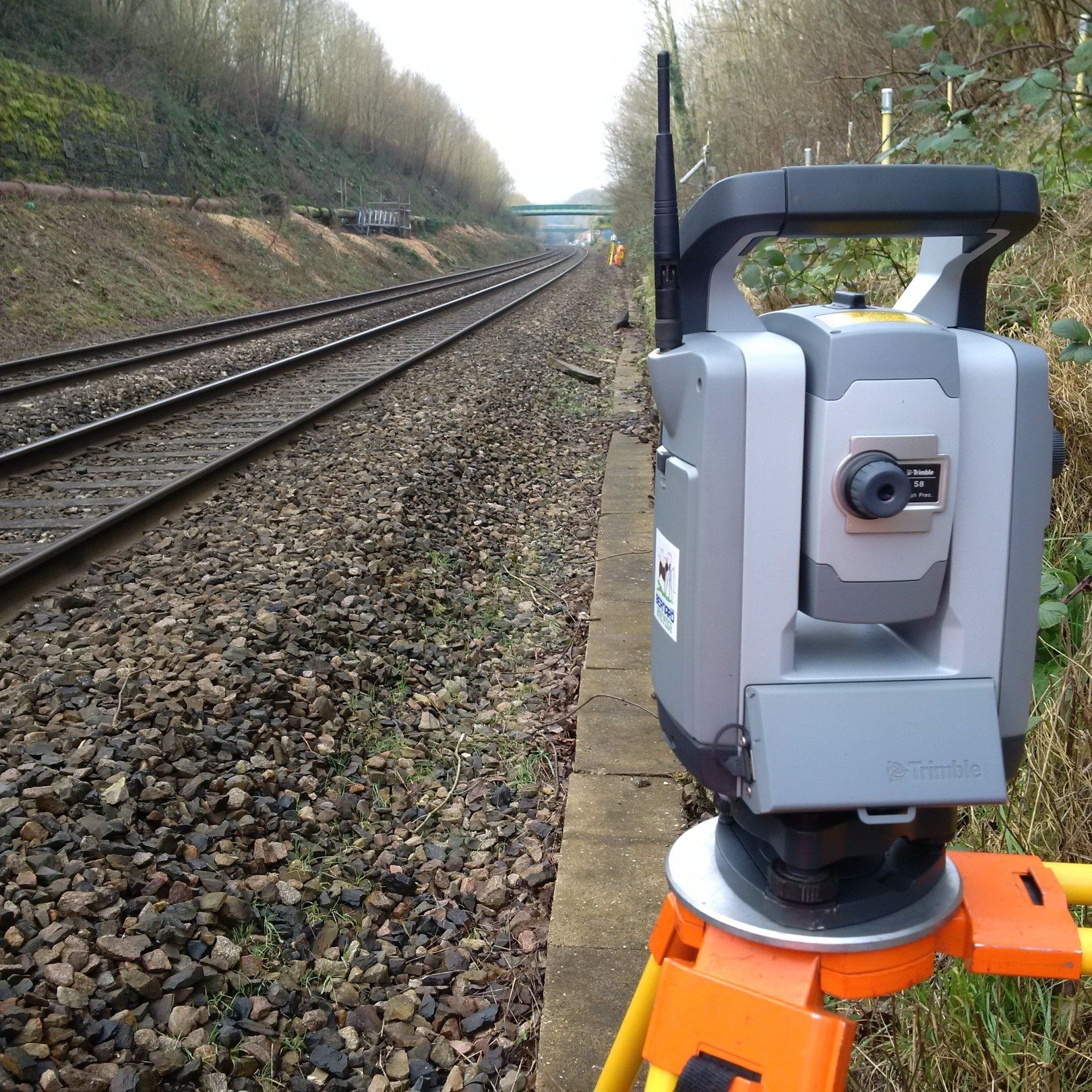
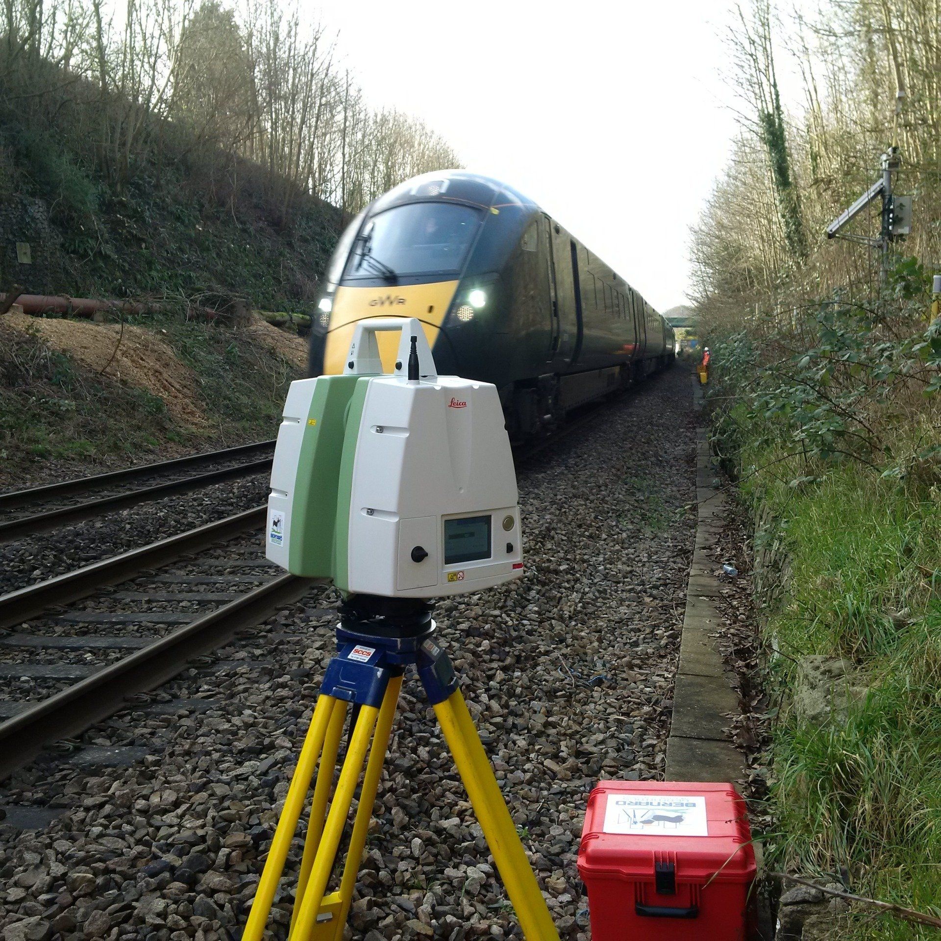
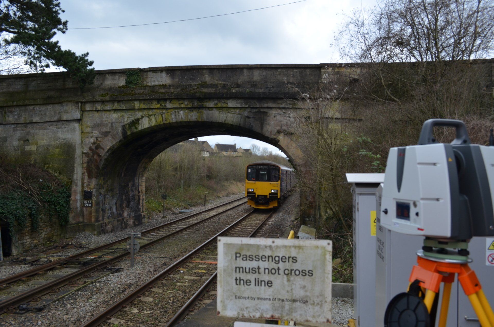
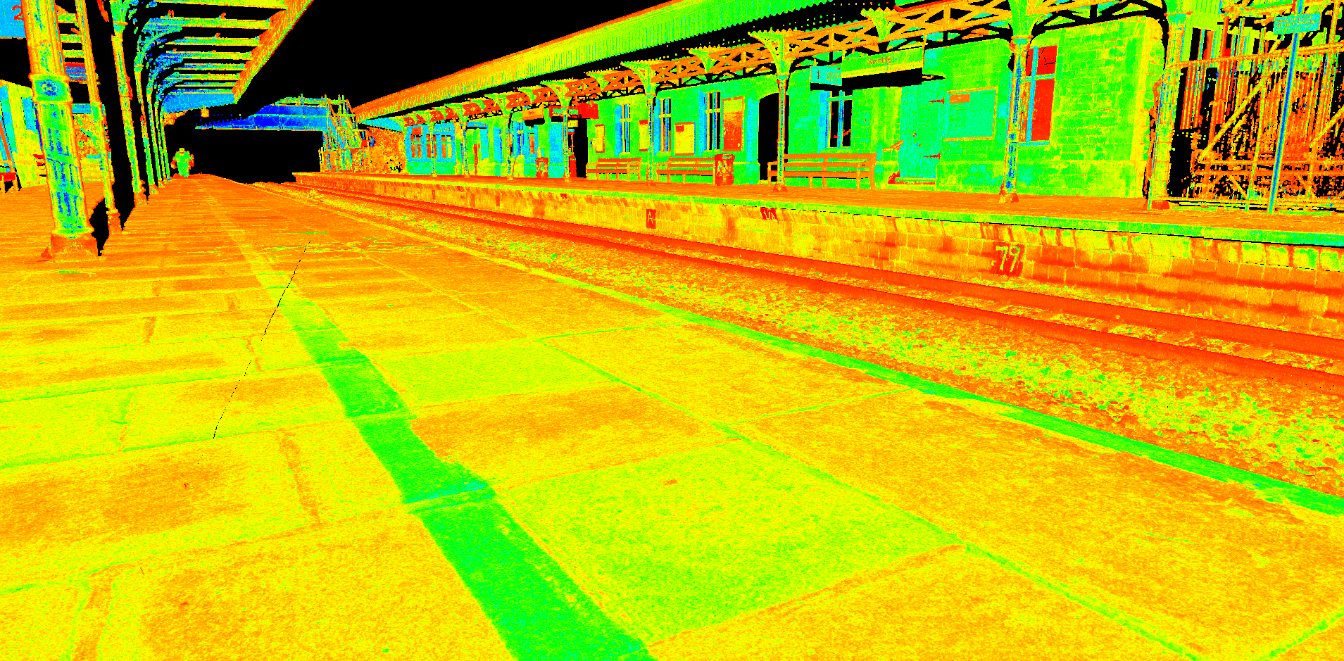
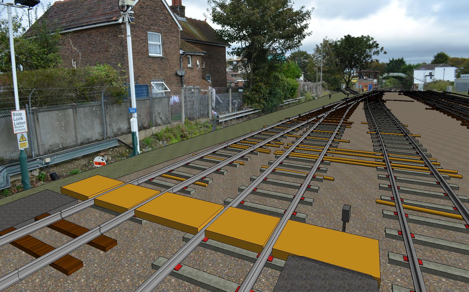
Railway Surveys
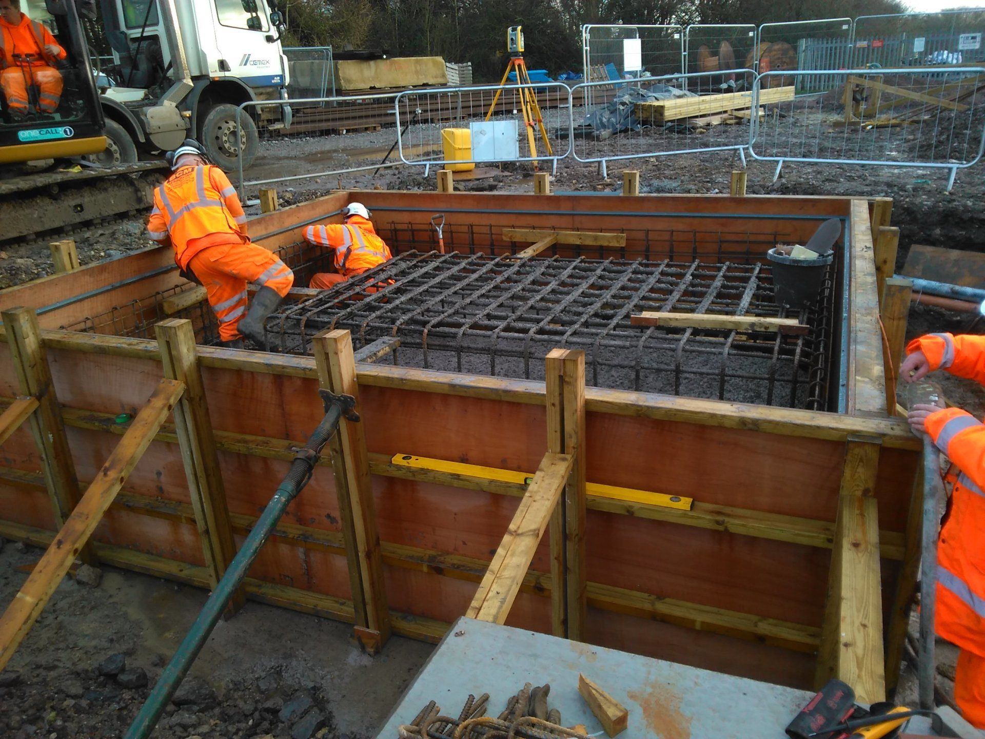
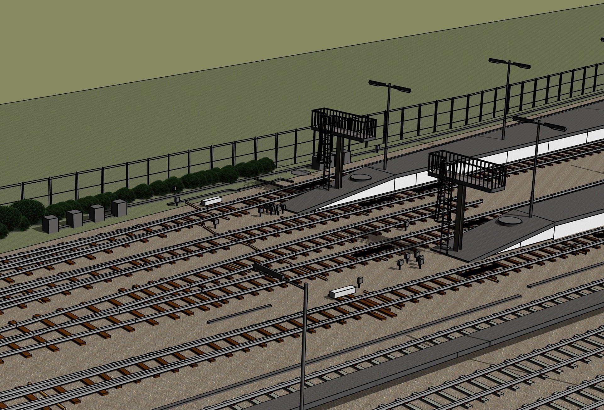
We provide a whole range of railway surveying services, including track and embankment monitoring, track setting out & installation and track as-built surveys, no matter the size, geographic location or complexity. Our railway surveyors have the skills, expertise and experience from working on several railway plain line and switches & crossings renewal sites, including ballast dozing, track tamping, sleepers, and modular S&C installations or new railway tunnels constructions.

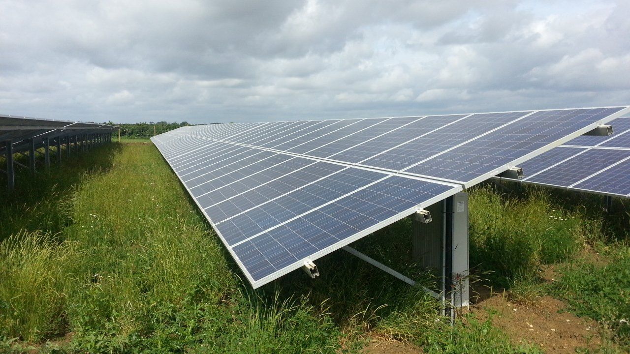
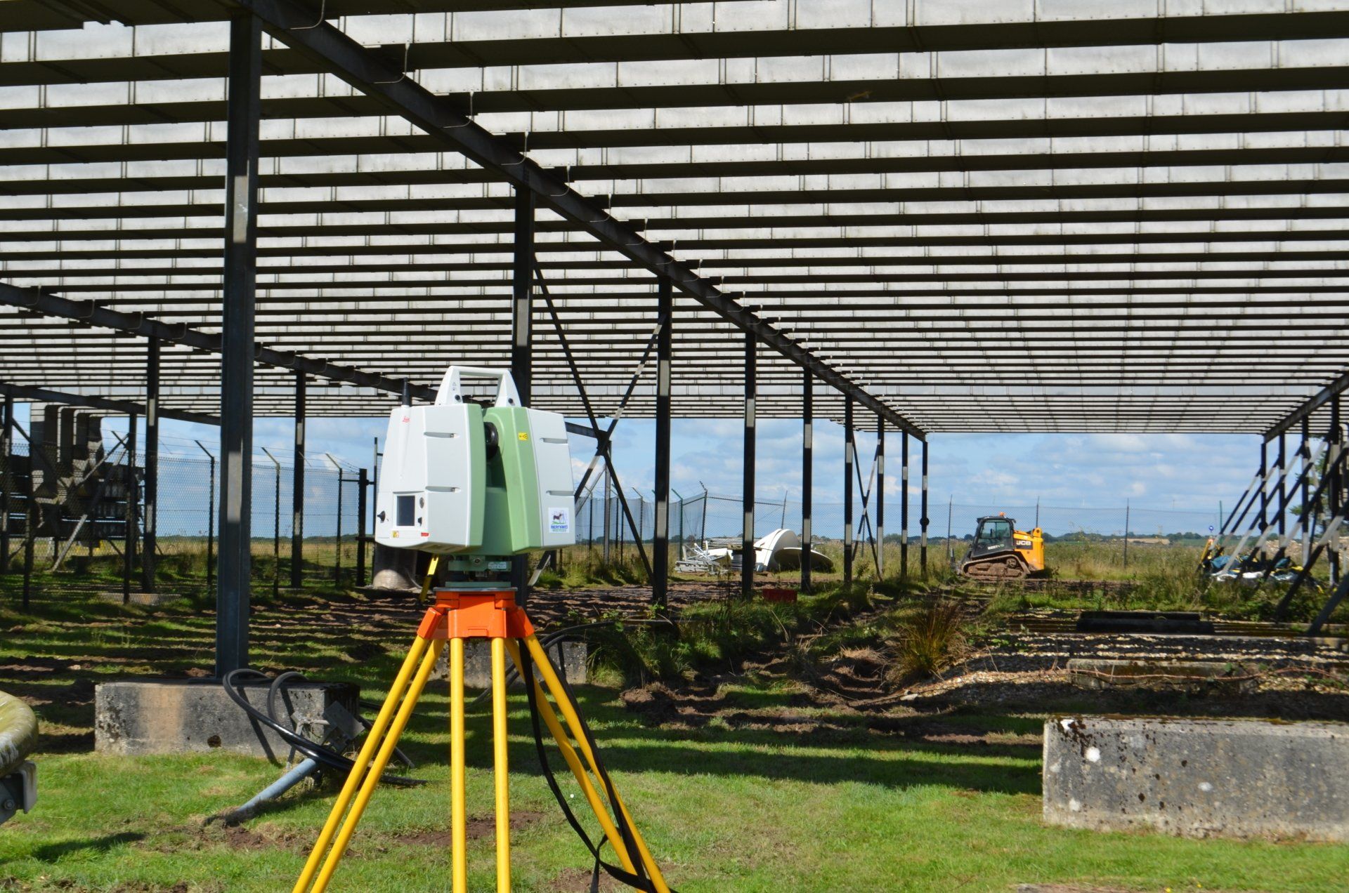
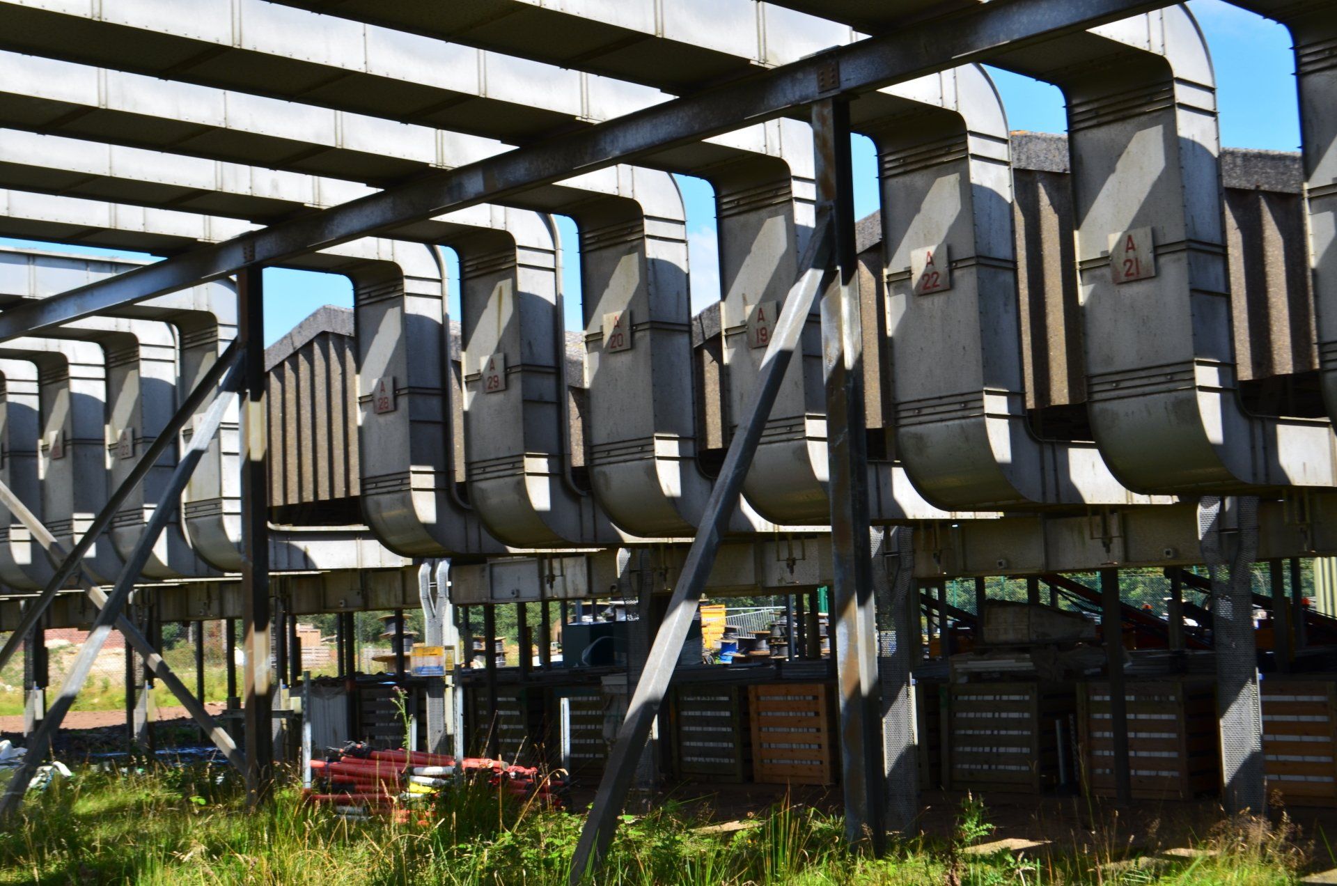
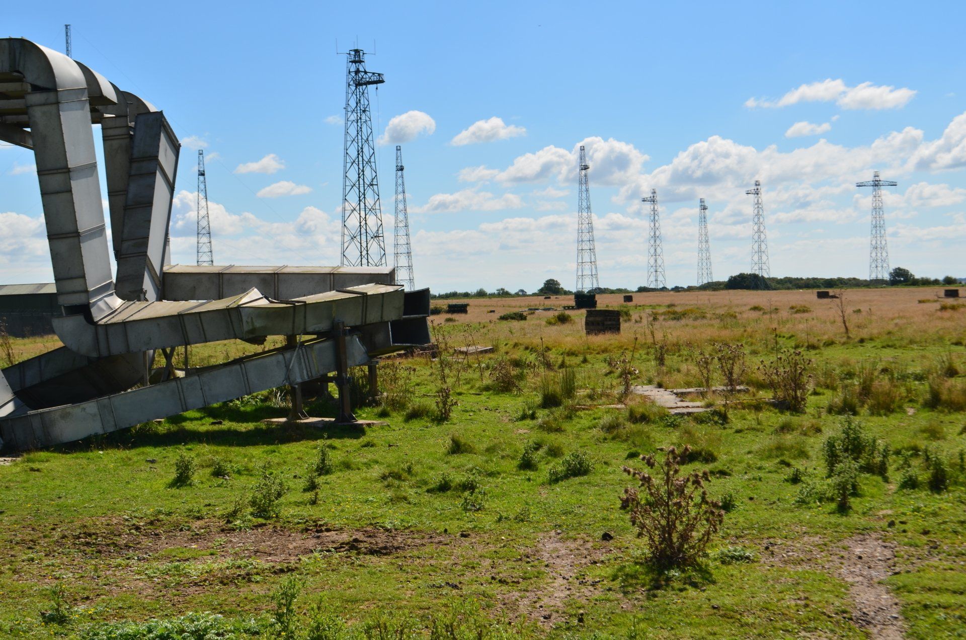
Renewable Energy
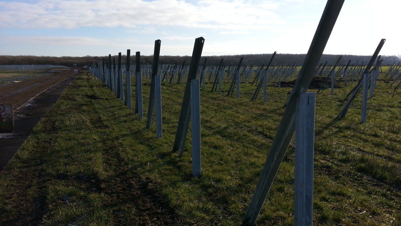
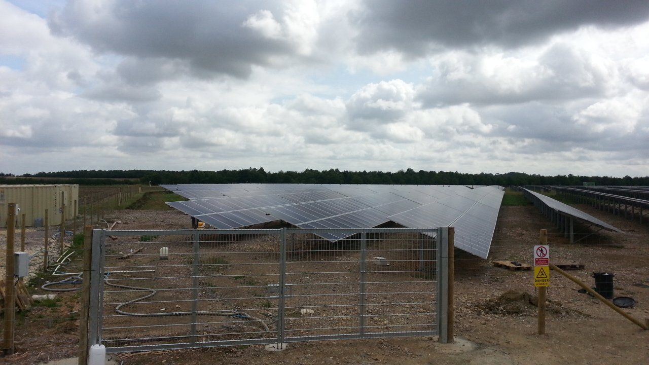
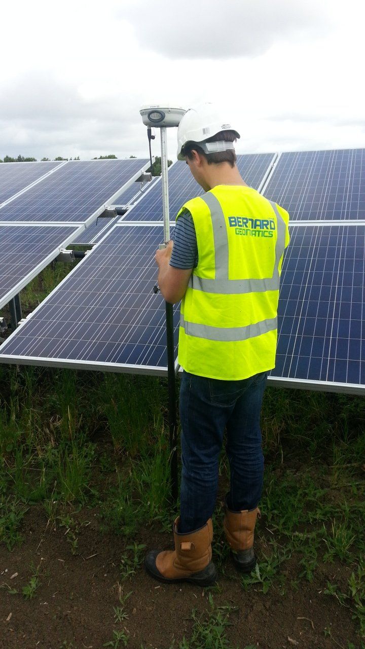
Each year our Renewable Energy survey team embarks on numerous engineering survey and setting out projects throughout the UK and Europe. We have undertaken well over 300 domestic and over 100 European projects. Using our wealth of experience, our surveyors are able to closely lease with the various civil engineers and designers in order to accurately stake out the positions of various roads, substations, transformers, PV Racks, and other features part of each renewable energy site and project.
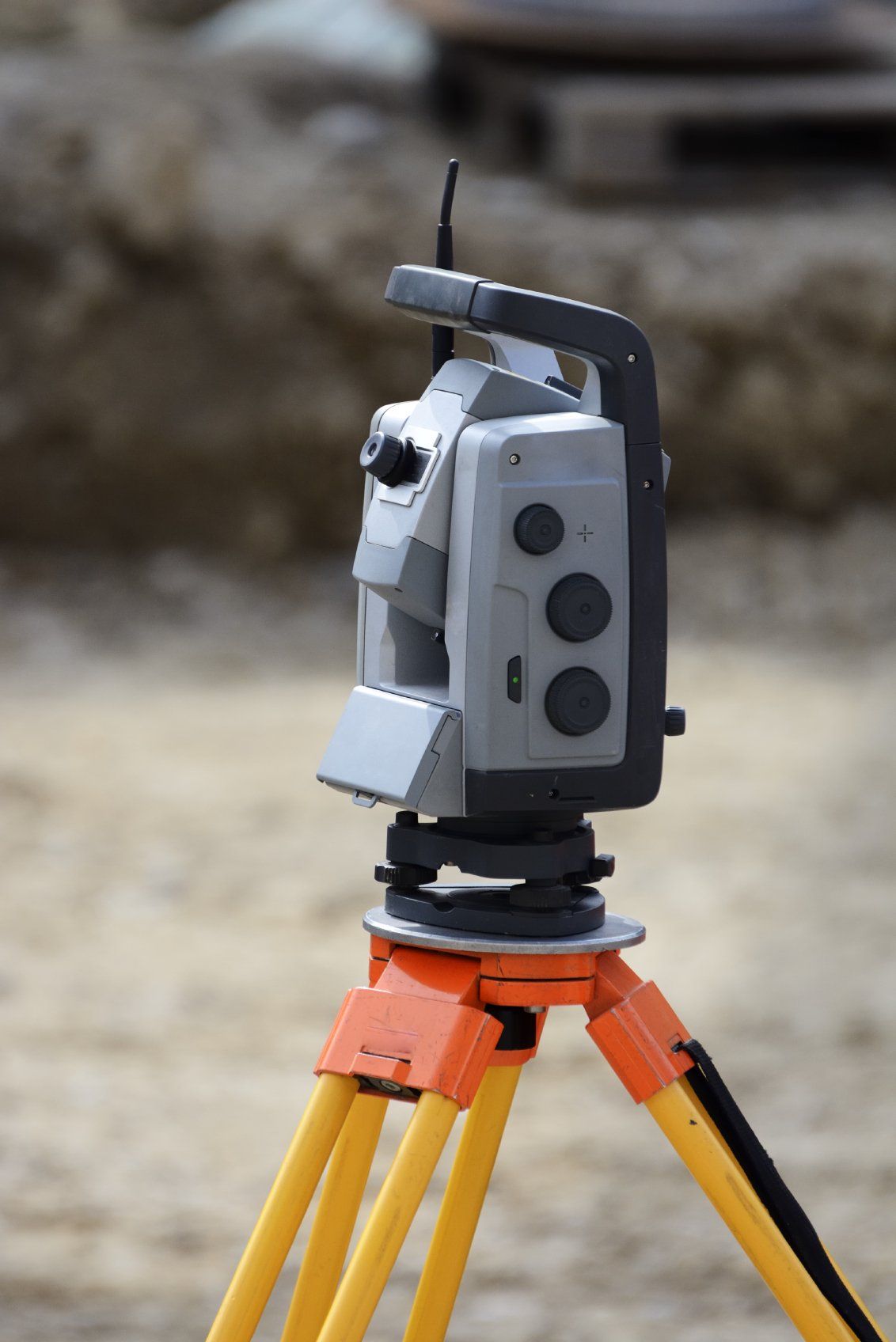
Engineering Surveys
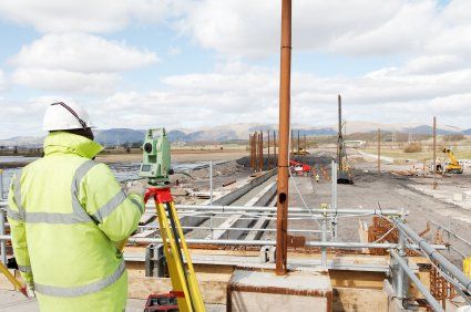
We serve the construction, planning and built environment with various engineering surveys that provide essential engineering support for many urban developments, large infrastructure projects and other civil engineering activities including, maintenance and restorations. Engineering surveying forms a critical part of any engineering project, hence our surveyors have extensive knowledge and experience that allows them to undertake accurate and highly reliable setting out and as-built surveys.
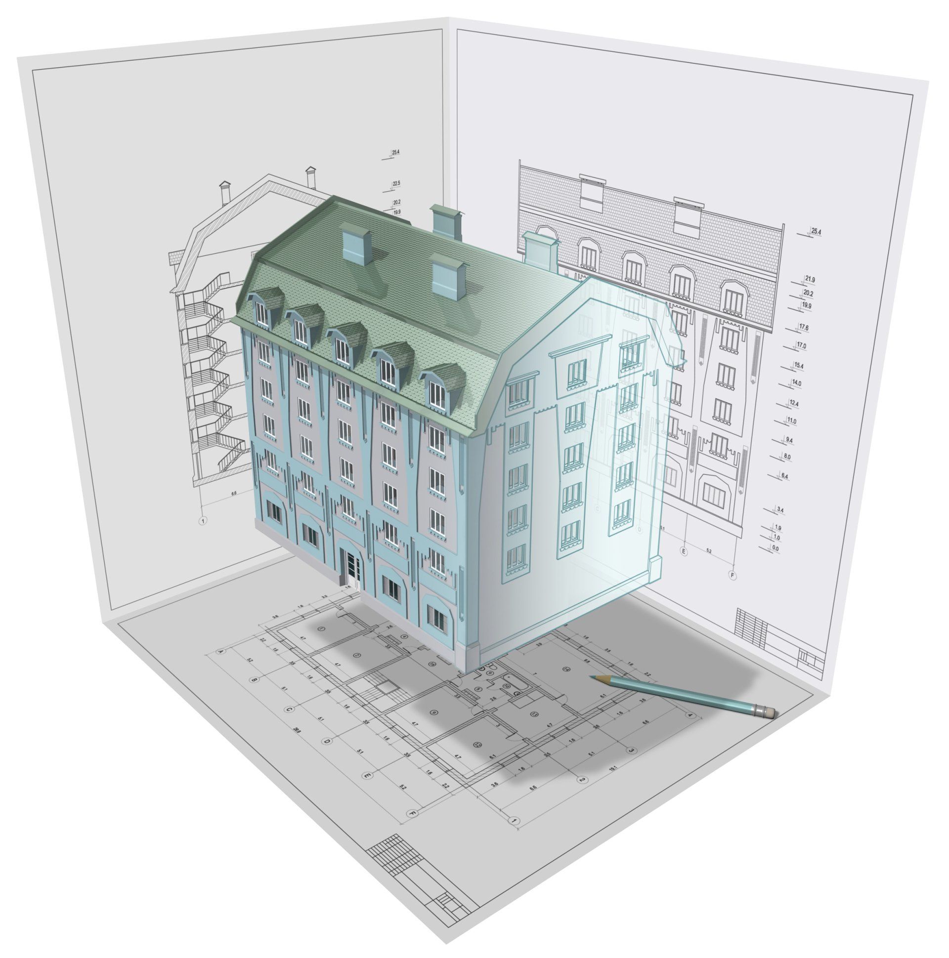
Measured Building Surveys
Measured Building Surveys
2D floor and roof plans, together with 2D external or internal building elevations, are the industry’s common requirement and desired product for architectural companies and architects who are looking to redesign space and add extensions. We are able to offer bespoke measured building surveying services tailored to clients' specifications and requirements, thereby saving money and time for unnecessary surveys that will not add real value to the client or the overall project.
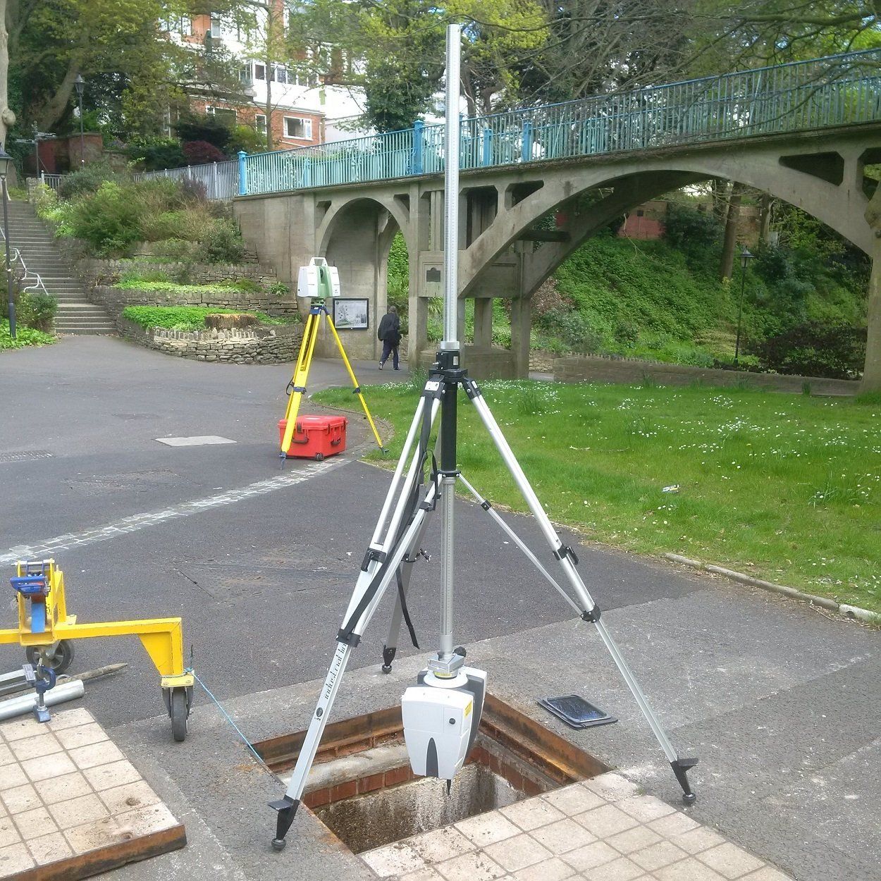
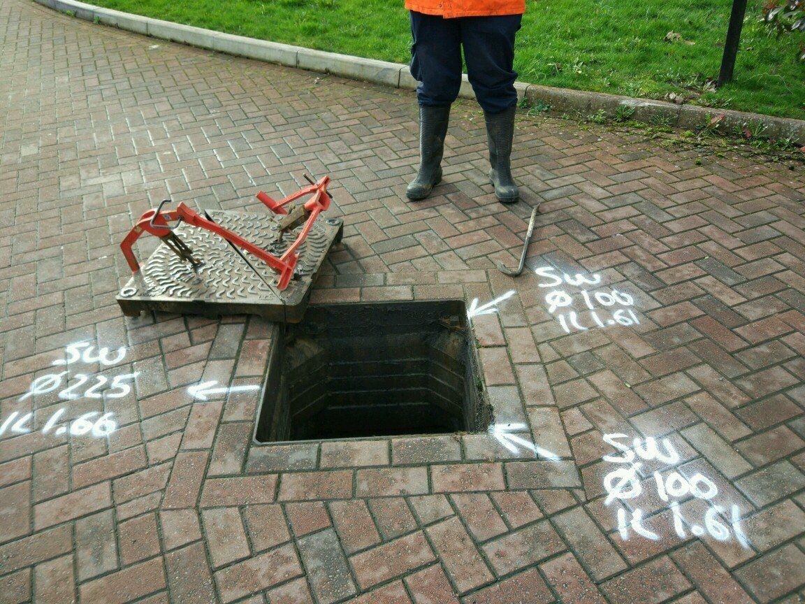
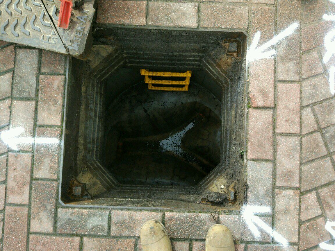
Sewer Tunnel Surveys
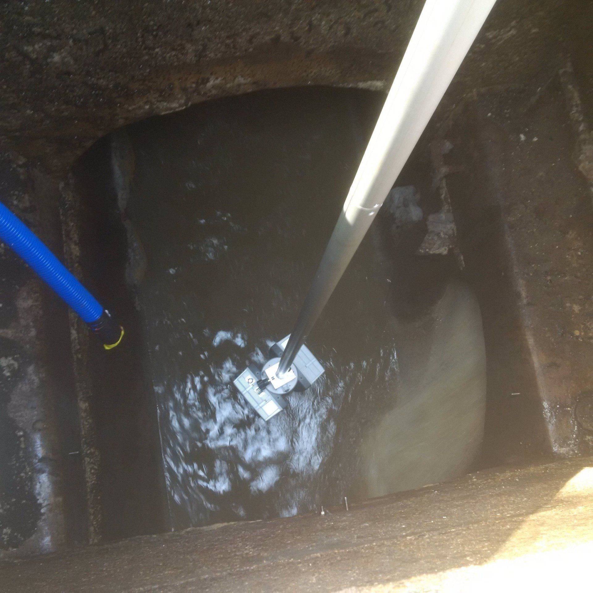
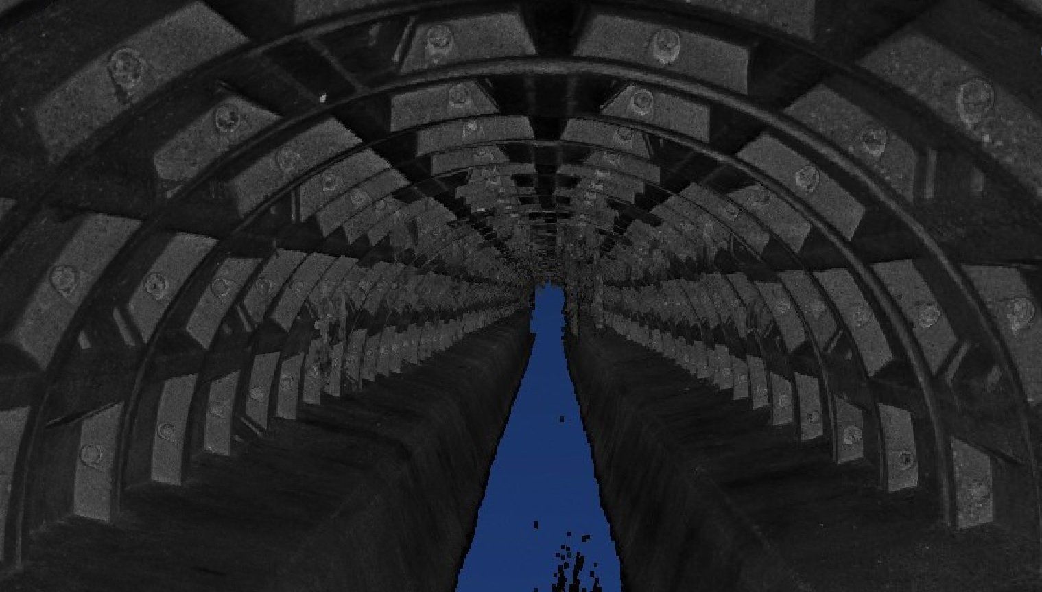
As a business, we are well recognised in the industry as pioneers in sewer tunnel surveying. To date, we have embarked on well over 200 different sewer tunnel surveying projects and have surveyed over 100miles of sewer tunnels and well over 1000 manhole shafts. Our high risk confined space trained surveyors, backed by specially modified industry-grade tripods, total stations, and laser scanners are able to survey the 3D position and condition of any sewer tunnel to any depth, length, or complexity.
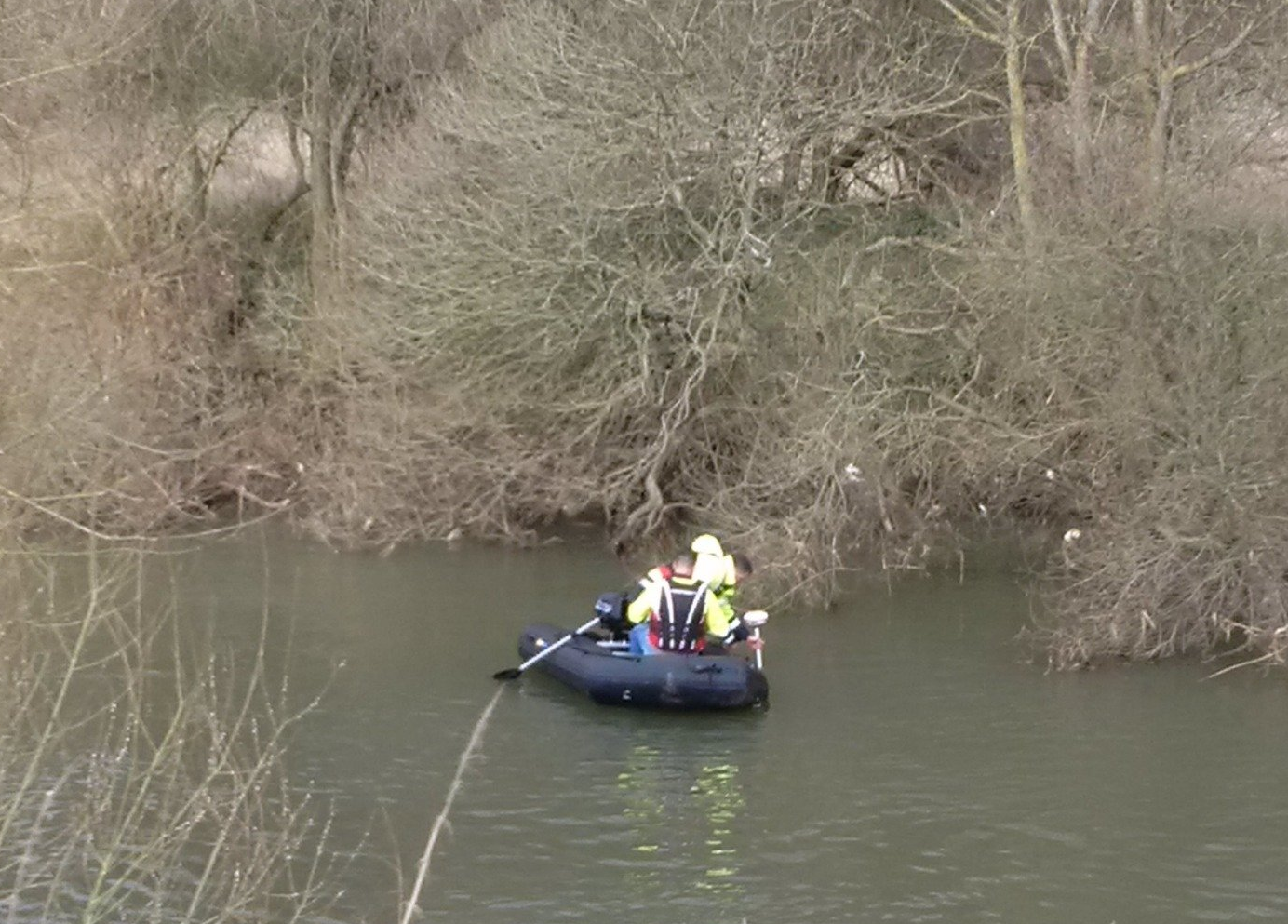
Hydrographical Surveys
We offer extensive experience of hydrographic surveys for the water and power industry and other organisations such as the environment agency. Our vast surveying experiace stretches throughout the UK and Europe and we are able to capture accurate geospatial data for a variety of purposes. Our specialist, qualified and RYA accredited team of hydrographic team of surveyors has the professional experience and determination that is need for conducting surveys within the water environment.
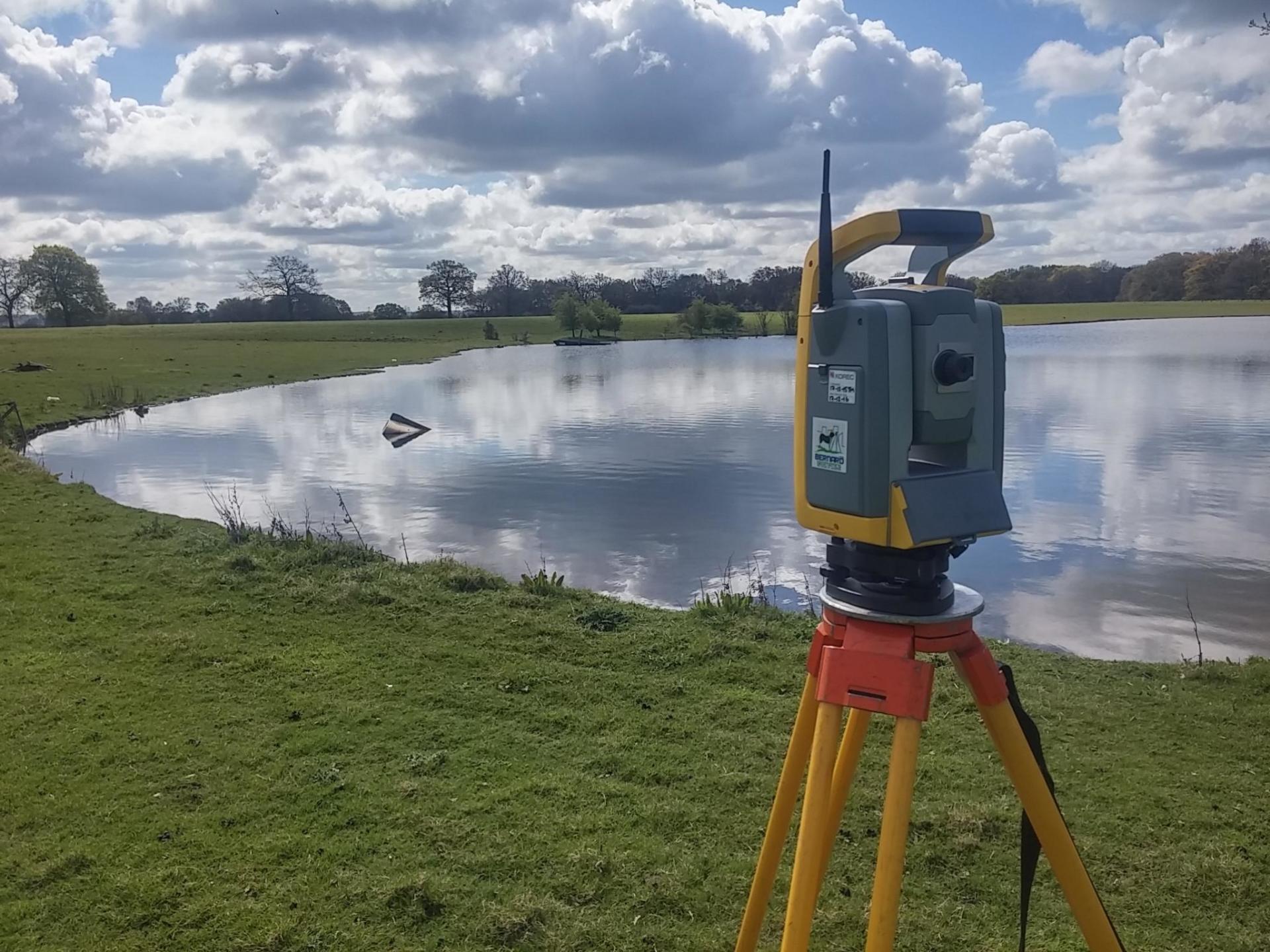
Monitoring & Deformation Surveys
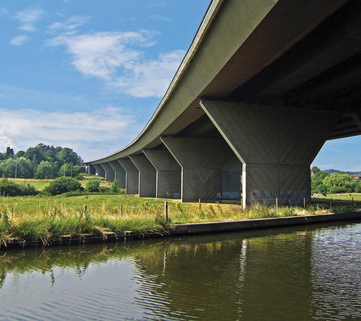
Using state-of-art high accuracy total stations, laser scanners and other monitoring systems and solutions we are able to provide bespoke monitoring and deformation survey solutions to the built environment where determining the magnitude and movement of any existing structure play a pivotal role and importance to the project. Tracking deformation or movement of cliff, embankment, viaduct or building will help the client to predict trends and prepare for any potential collapse or alteration.

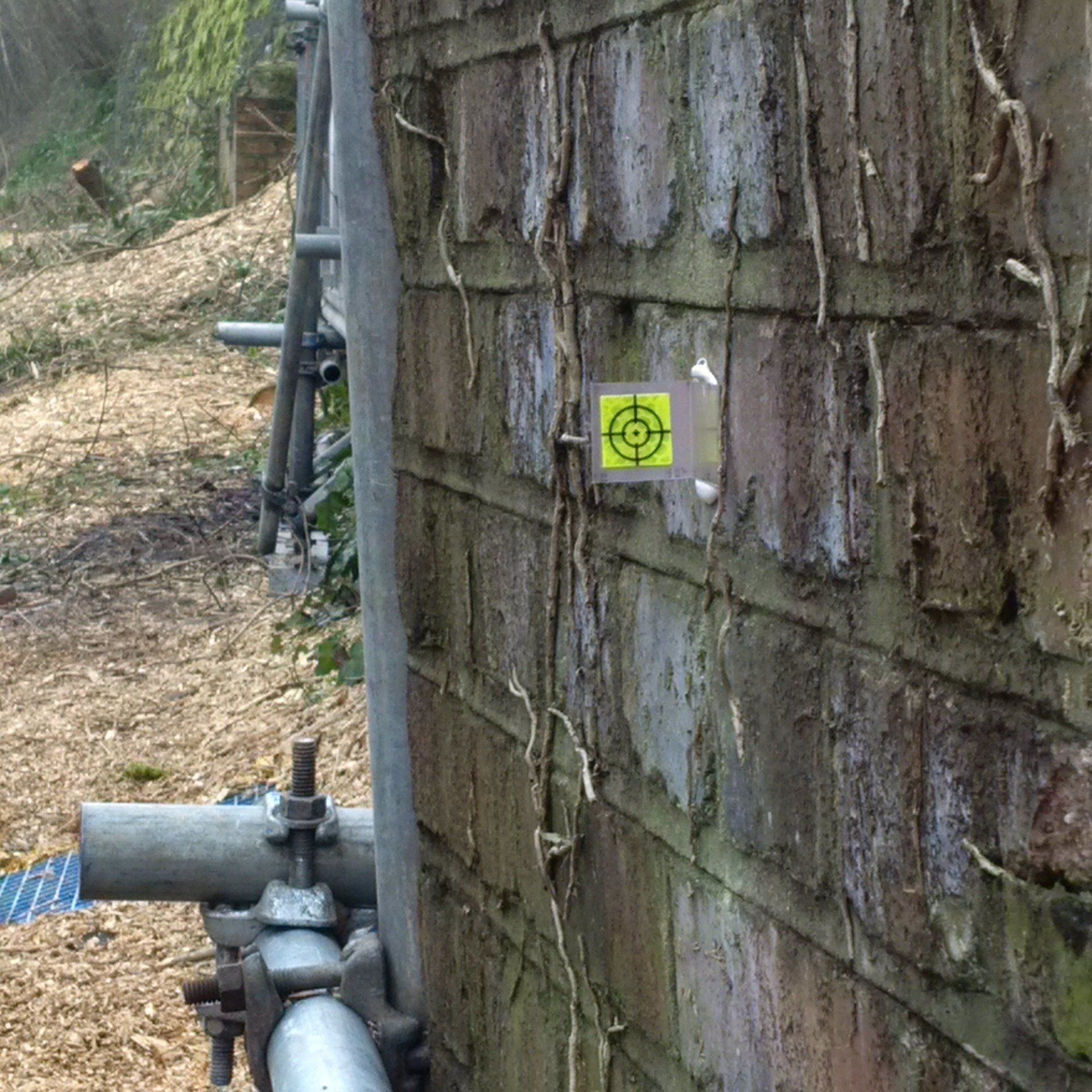
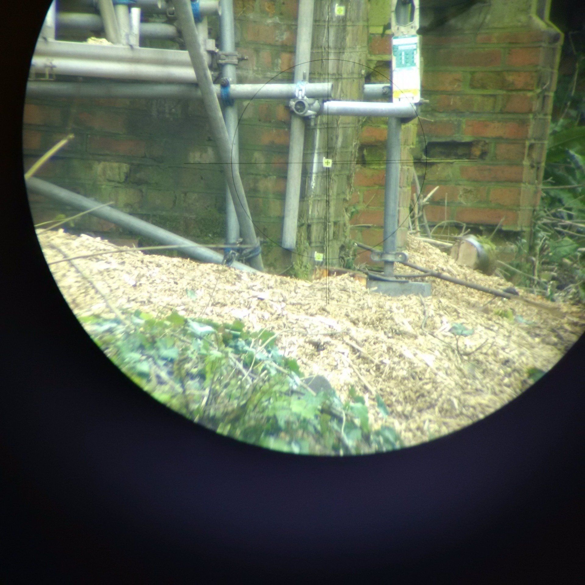
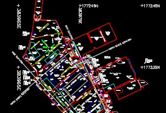
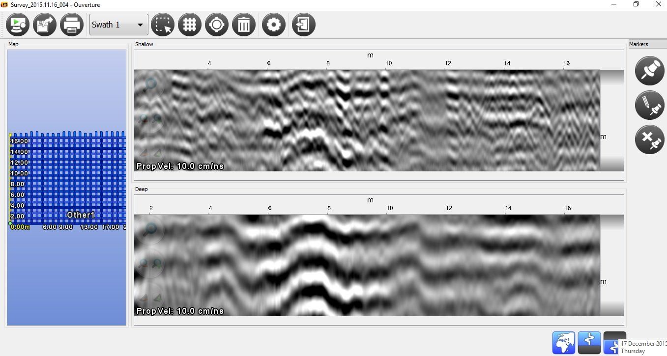
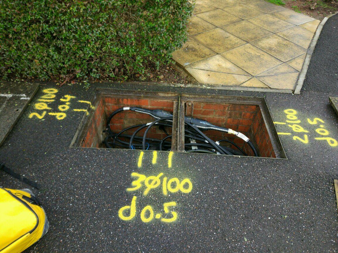
Underground Utilities Mapping
Underground Utilities Mapping
Each week our Ground Penetrating Radar and Utility Tracing surveyors engage in the verification and location of various underground utility projects throughout the UK and Europe. Our utility surveyors strictly comply with British Standards Institution PAS 128:2014 Specification for underground utility detection, verification and location and our final deliverables include a full set of drawings and reports tailored to clients' requirements and in accordance with defined standards.

Condition Surveys
We undertake a variety of condition survey to fully understand the condition of your land, road, culvert, building, sewer or another type of asset in order to either assist you with planned maintenance work or to record the current condition prior to major civils works taking place at or in the vicinity of your asset. Our surveyors have extensive knowledge, professional expertise and experience to produce a bespoke condition survey report based on our wealth of knowledge and experience in the industry.
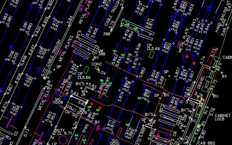
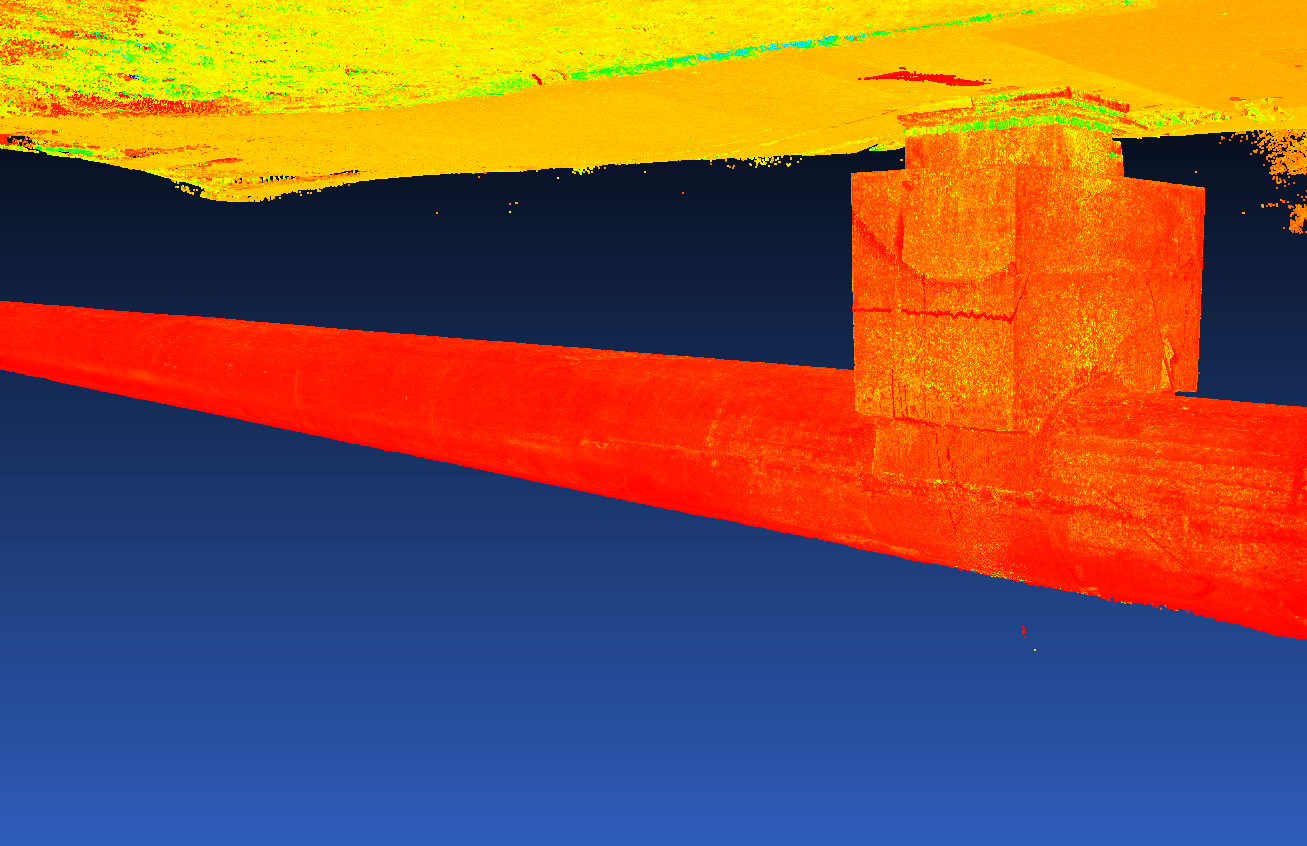
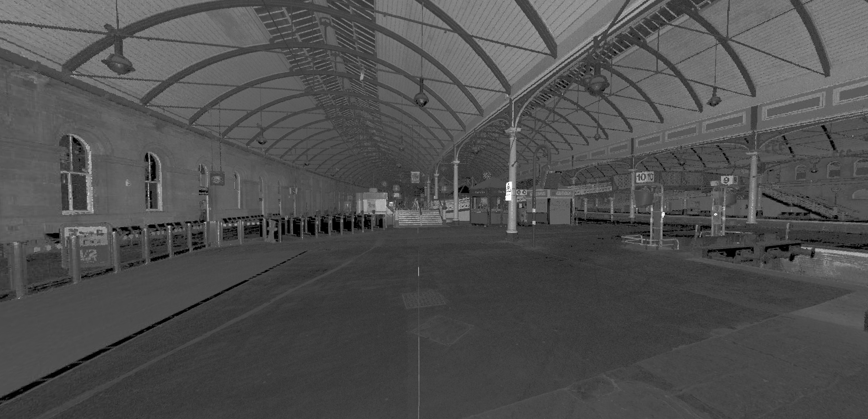
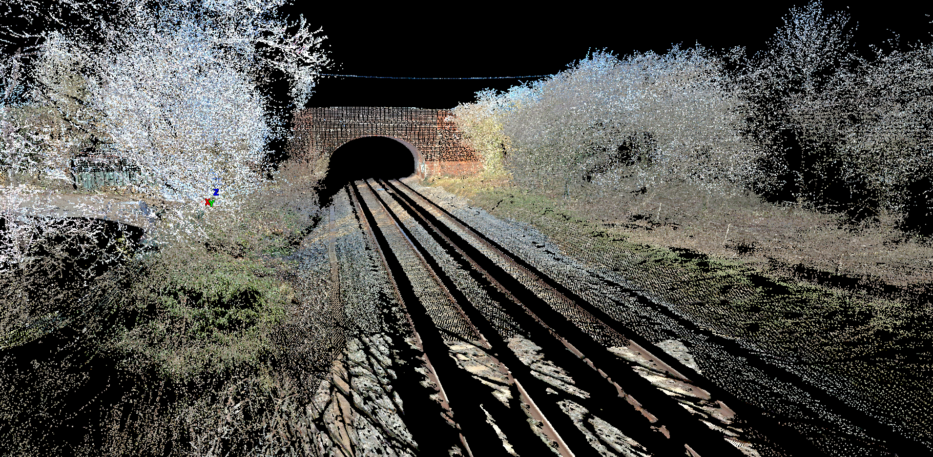
Terrestrial Laser Scanning
We are able to offer state-of-art terrestrial laser scanning for various ground-based projects such as to survey railways, bridges, cliffs, sewers, tanks, fields or embankments, where otherwise traditional methods will be either too dangerous or very time consuming and not cost-effective. Our scanners are capable of recording an array of dense point clouds over ranges up to 1km and the resulting point cloud can be used for various purposes including, 3D modeling, visualisation and morphometric measurements.
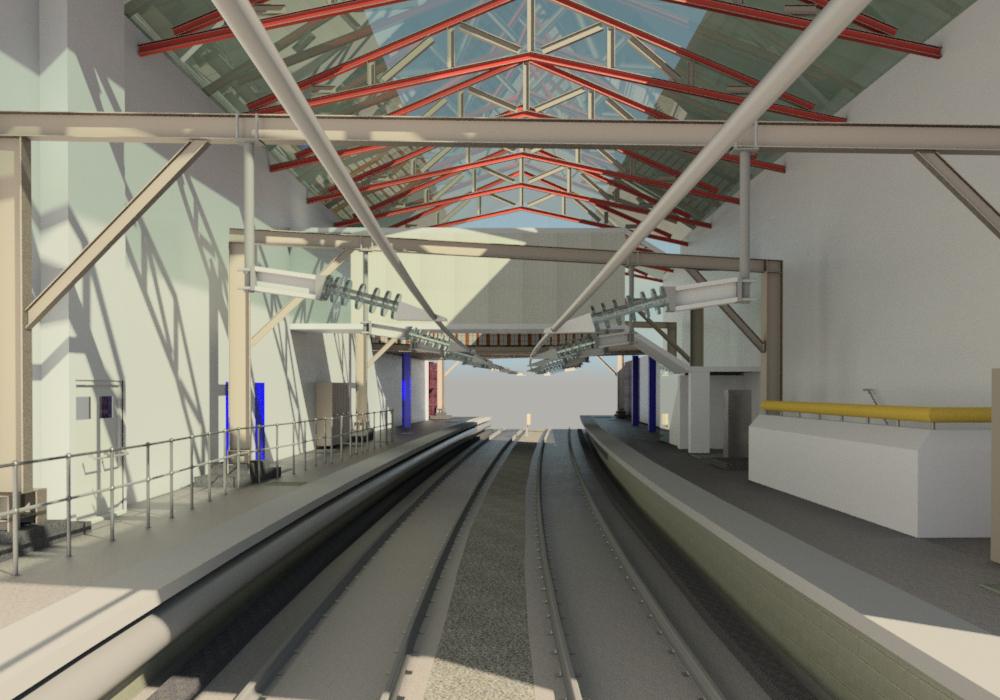
Scan to BIM
Since the UK construction industry has launched the BIM digital revolution, Bernard Geomatics Limited has taken an active role in following industry trends and standards. Our surveyors, backed by our state-of-art laser scanning technology and powerful desktop hardware and software applications have been able to produce many 3D revit models for BIM purposes that show the true geometric characteristics of objects and features with real-life information as accurately measured on site.
All the surveying services you need,
all in one place at Bernard Geomatics Limited.
All the surveying services you need,
all in one place at Bernard Geomatics Limited.
We offer a wide range of services to meet every type of need.
All survey activities are undertaken by our internal survey resources. Our surveyors have a minimum of five years of professional experience, a Degree in Land Surveying and Geomatics Science and professional accreditation. Also, our surveyors are NC4 and GPR certified surveyors, therefore, no third party surveyors or companies are used or appointed on behalf of Bernard Geomatics Limited to undertake any of our services.
Interested in our services? We’re here to help!
Interested in our services? We’re here to help!
We want to know your needs exactly so that we can provide the perfect solution. Let us know what you want and we’ll do our best to help.